Google 今天透露了旗下 Advanced Technology and Projects group (ATAP) 一個新發展項目 Project Tango。
The goal of Project Tango is to give mobile devices a human-scale understanding of space and motion.
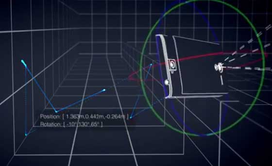
我們生活在一個 3D 世界,透過眼睛可觀察周遭物件,判斷位置距離。透過 Project Tango,手機也可以跟人一樣理解判別空間。
好抽像?就是手機可以識別自己的3D移動,並透過手機特設的感應器對周邊環境量度,每秒可作出 250K 量度,並可以實時更新手機自己的位置和方向,將這些數據資料整合就可以製作成 3D 地圖影像模型。(最下亦有一段 Project Tango 影片介紹,內裏也有一些展示)
These sensors allow the phone to make over a quarter million 3D measurements every second, updating its position and orientation in real-time, combining that data into a single 3D model of the space around you.
長遠可以發展成什麼功用?
當一個 3D空間可以用數據表達就可以帶來很多方便,最基本最直接功能就是室內地圖導航,另外也可以用作量度室內空間用作裝修買傢俬,協助視障人仕在不熟識的地方行走,甚至用作搜尋大型商店內貨架物品擺放位置,甚至用作機械人操控。
這個技術也可以應用在遊戲內,例如:在家中跟虛擬卡通人物玩捉迷藏,又或在真實世界收藏一些虛擬物件。
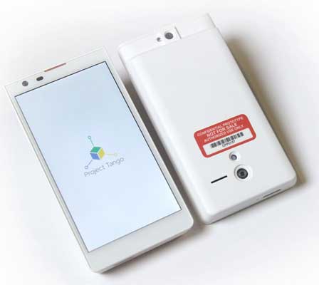
Project Tango 已經生產了一批200套 5吋 Prototype 手機 Developer Kit 可以讓有相關 Idea 的 Developer 使用。
Currently, we have 200 prototype dev kits. We have allocated some of these devices for projects in the areas of indoor navigation/mapping, single/multiplayer games that use physical space, and new algorithms for processing sensor data. We have also set aside units for applications we haven’t thought of yet. Tell us what you would build. Be creative. Be specific. Be bold.
有興趣可以到 Project Tango 網頁查看
http://www.google.com/atap/projecttango/