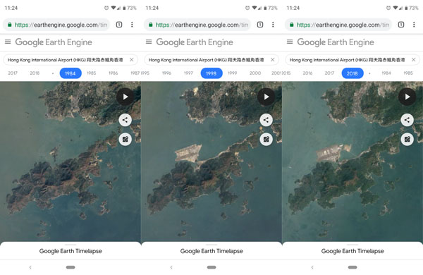
Google 推出了新的 Google Earth Timelapse 功能,可以回望由 1984 起地球表面的變化。
Google Earth Timelapse, a global, zoomable time-lapse video that lets anyone explore the last 35 years of our changing planet’s surface—from the global scale to the local scale
Google Earth Timelapse 整理超過 1500萬張䘙星圖像,並以時間方式排列,用家可以按年檢視地形上的變化。透過 Google Earth Timelapse 可以看到地球不同地點的變化,例如巴西亞馬遜雨林, 澳洲北領地等。當然也可以看看香港的變化,例如香港赤鱲角機場,未起機場前赤鱲角是一個離島,移山填海後就建成機場島。下面就 capture 了 1984年, 1998年, 以至 2018 年的情況。

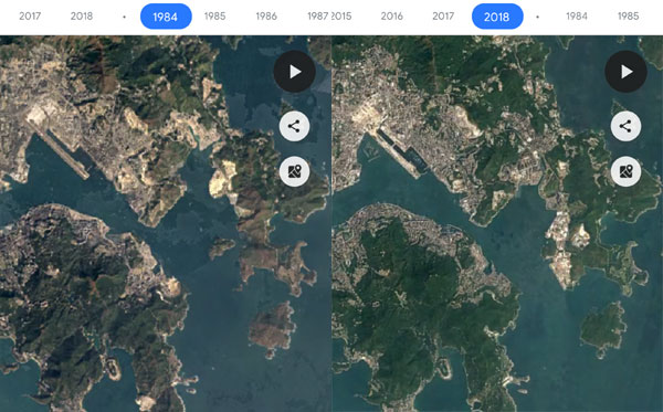
香港另一個變化很多的地區就是將軍澳,填了很多地呢。

Google Earth Timelapse亦設有 Autoplay 播放功能,可以連貫看到 1984年至到 2018年的變化。Google Earth Timelapse 可以在桌面電腦以至電話上直接使用,只要按下面的連結在瀏覽器開啟就可以。
https://earthengine.google.com/timelapse/